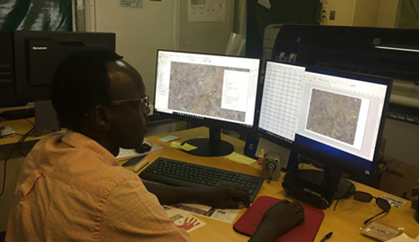
QGIS used by Malakal GIS Team in the United Nations Mission in South Sudan (UNMISS)
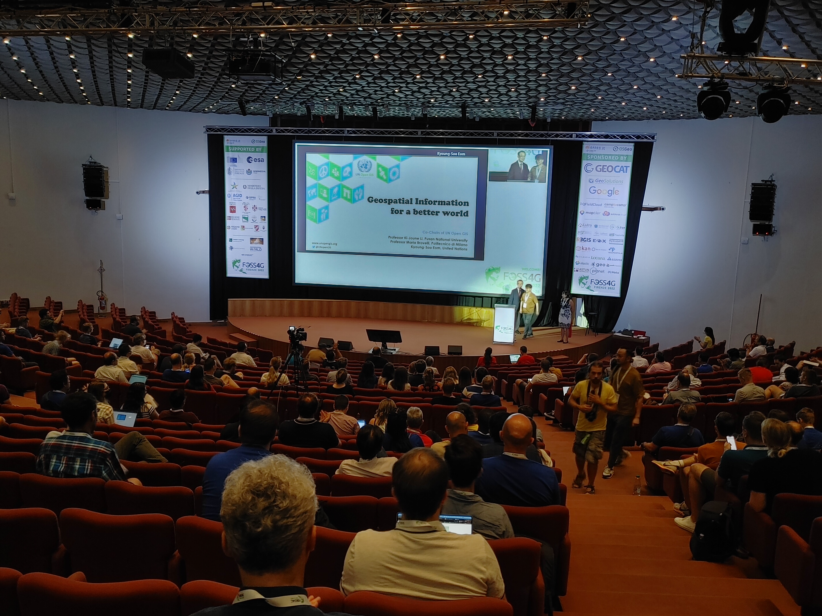
2022 FOSS4G Keynote Speech
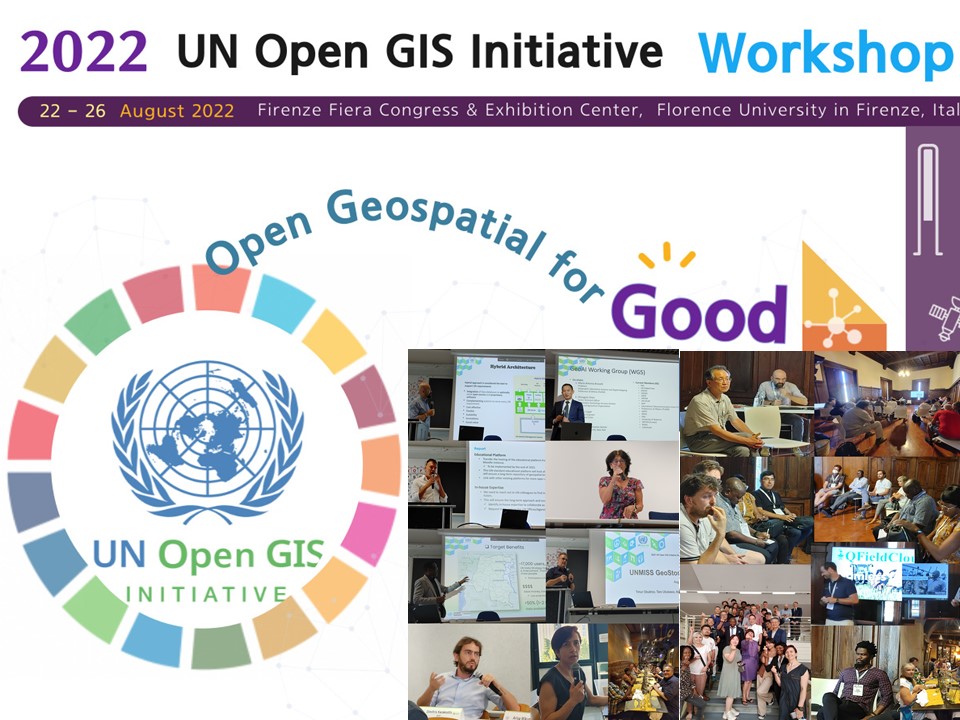
2022 UN Open GIS Initaitive Workshop in Firenze, Italy
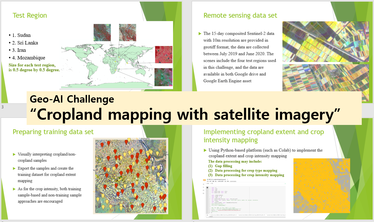
WG5: GeoAI Challenge for Cropland Mapping with Satellite Imagery curated by FAO
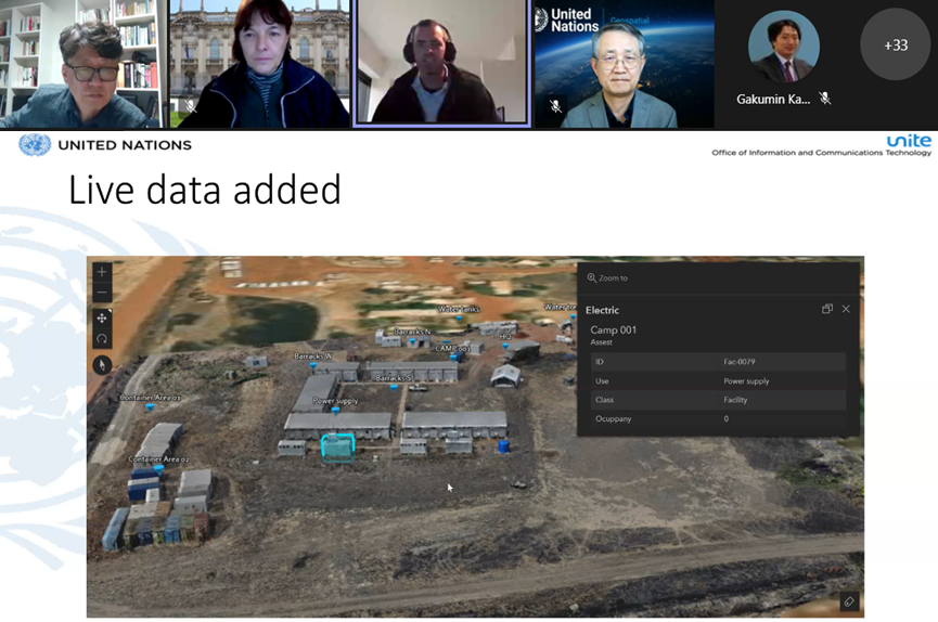
'UN Live Map' for the 'Digital Twin of UN Camp', built by using OpenDroneMap
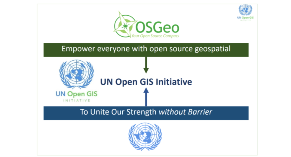
Goal of UN Open GIS Initiative
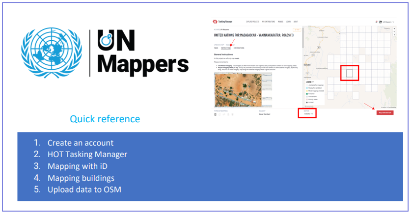
Download a Quick Reference Guide for UN Mappers
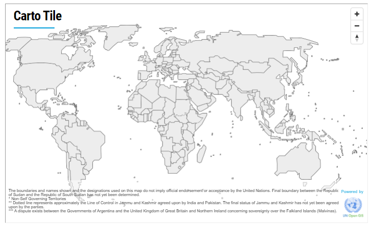
'Carto Tile' web service provided by the UN Geospatial and powered by UN Open GIS Initiative
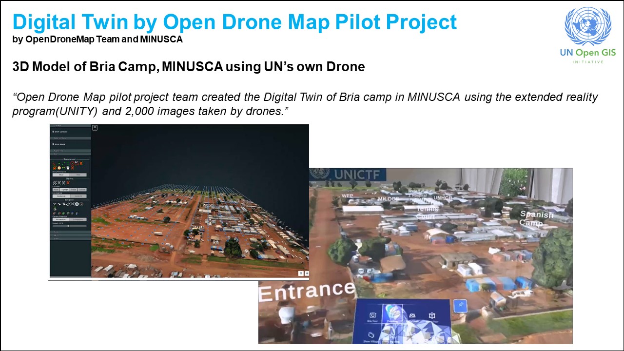
Digital Twin of Open Drone Map
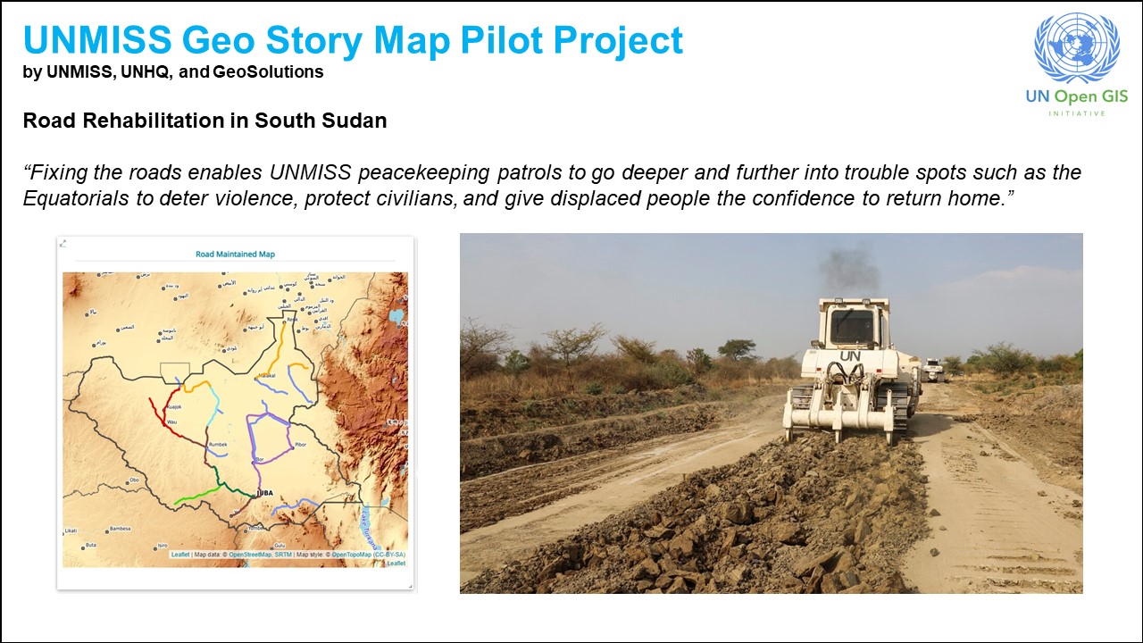
UNMISS Geo Story Map Pilot Project