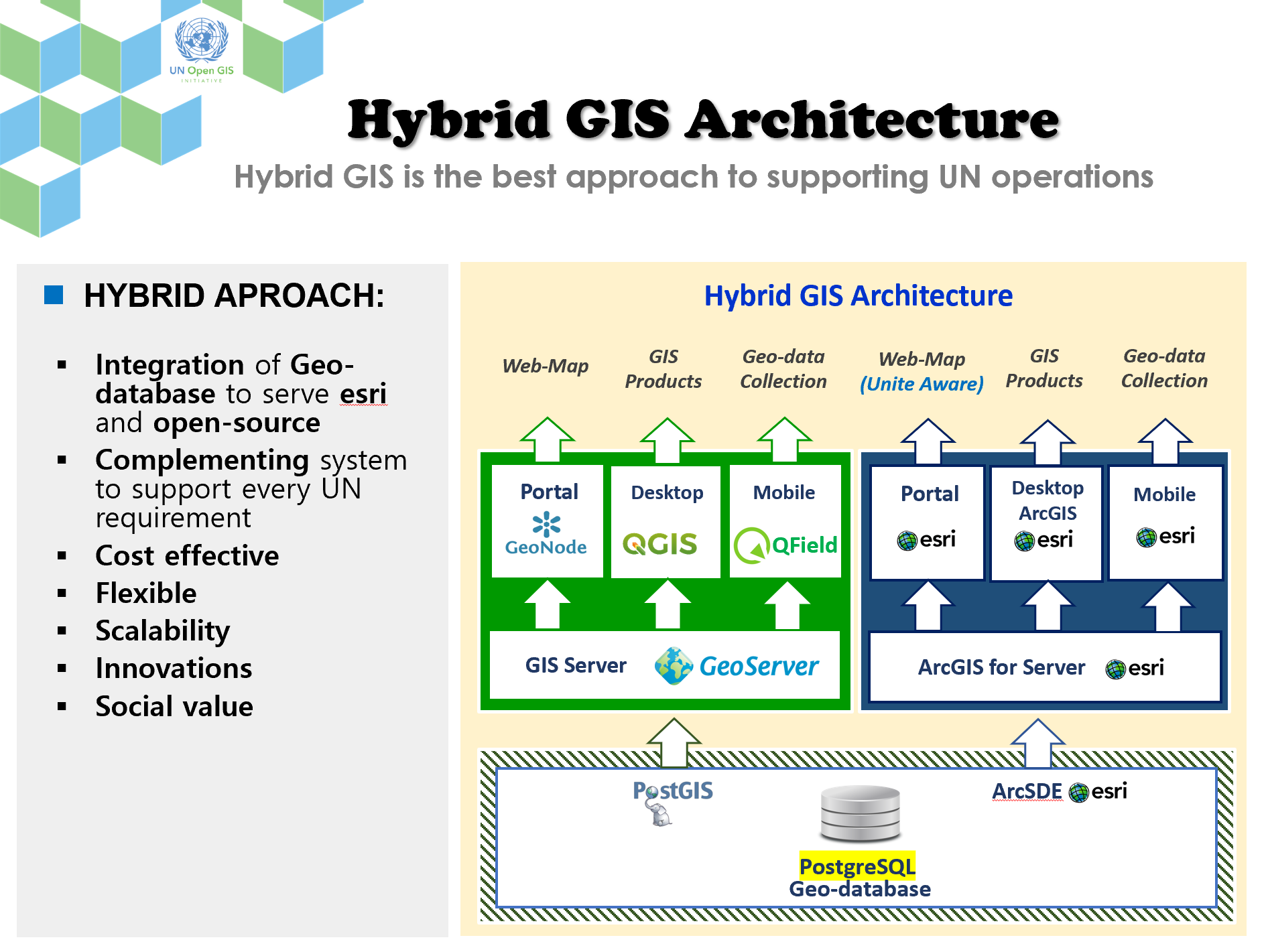
DWG 1: Hybrid GIS Platform
The Working Group 1 (WG-1) of UN Open GIS Initiative aims to
provide a full scale of Hybrid GIS Solutions for UN Secretariat,
including UN field missions and regional commissions, and then
expand to UN agencies, UN operating partners, and developing
countries. Hybrid approach will effectively support UN operations
through integrating Geo-Databases and complementing systems to
support various UN requirements.
WG-1 has initiated Pilot Project in 2020 for proof of concept
through design and implementation of hybrid GIS prototype to
support Unite Map & Open GeoPortal. Main contributors are Korea
Research Institute for Human Settlements (KRIHS), World Food
Programme (WFP), UN Global Service Centre (UNGSC), UN Geospatial
Information Section (UNGIS) and GeoSolutions.