Overview
About UN Open GIS Initiative | Providing free open source GIS software for UN operations
About UN Open GIS Initiative
Who runs? The UN Open GIS Initiative is an ongoing Partnership Initiative for Technology in Peacekeeping of United Nations Department of Operational Support (UN DOS). It has been running by the United Nations Geospatial in the Office of Information and Communications Technology, UN DOS since March 2016.
Governance Structure of UN Open GIS Initiative | Providing free open source GIS software for UN operations
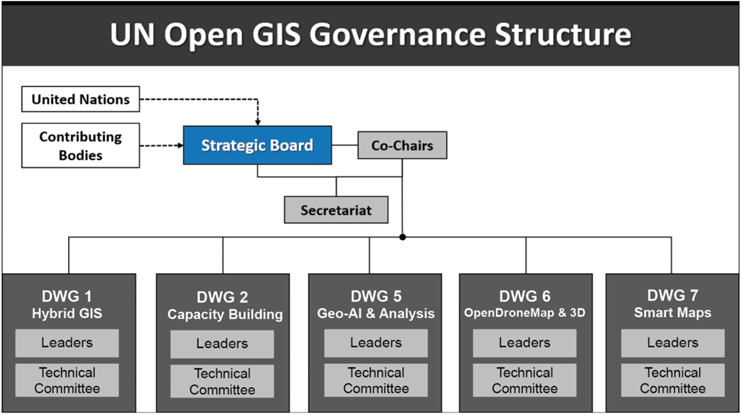
Governance Structure
The UN Open GIS Initiative's governance structure comprises a Strategic Board, Co-Chairs, a Secretariat, and Domain Working Groups. The UN Open GIS Initiative was founded through a collaborative effort, bringing together open-source GIS experts from various countries, organizations, and academic institutions to leverage open-source GIS technology in support of UN operations.